Don't Buy the Godzilla Ticket Yet
The “Super” El Niño, the Sierra, and the old salt's case for wait, watch, and see.
#MotherNature and Ole Neptune are talking again, and half the internet has already booked the parade. Scroll any feed this month, and you trip over the same breathless words set in forty-point type. SÚPER EL NIÑO. Godzilla is back. Biblical POW. Epic winter locked and loaded. Buy your pass, wax the quiver, the Gods have spoken.
Here is the thing about #MotherNature and Ole Neptune. They talk in probabilities, not promises. And right now, from my seat here at the #HippieHaus with a Cup'☕️'Joe and NOAA's work open on the desk, I am here to give you the honest, unsexy, deeply Tahoeian truth. It is too early. The signal is real, the outcome is not, and the only rational move on the board is to wait, watch, and stay thirsty for POW.
Let me walk it the way an old AST mind walks a sit-rep. Facts first. Feelings second. Hype dead last.
The ocean really is loud. That part is true.
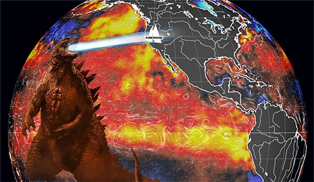
I will not insult you by stating that nothing is happening out there. Something is. NOAA's Climate Prediction Center dropped its diagnostic on July 9, and the language is not shy. The El Niño Advisory #FreakFlag is flying. The central and eastern equatorial Pacific is running warm; the latest weekly Niño-3.4 reading sits just north of a full degree Celsius, and a downwelling Kelvin wave just slid east, deepening the warm water as if someone had stoked the furnace. CPC now puts the odds of this thing going VERY STRONG through the heart of autumn at better than eight in ten, an event that would stand among the biggest in the record books going back to 1950. They give it a 97% shot at hanging around into early spring.
So no, this is not a nothingburger. #MotherNature is genuinely flexing. If you only read the sea-surface numbers, you would be forgiven for booking Mammoth in ink.
But sea-surface numbers are the map. The Sierra is the territory. And anybody who has spent a winter on Carson Pass knows the map and the territory are not always on speaking terms.
“Super El Niño” is a headline, not a forecast.
A little rationality hygiene first, because this is exactly where the hype machine cheats. “Super El Niño” is not an official category. NOAA does not use the term. It is media shorthand for a very strong event, meaning that patch of tropical Pacific running two degrees or more above average. It measures how warm one stretch of ocean is. It does not measure how much POW we measure, see, or chase out here in the West. Those are two different questions, and the whole grift of the hype cycle is smuggling the first answer in wearing the second one's jacket.
This is the lesson I will keep hammering because it is the entire game. A strong cause tilts the odds. It does not dictate the result. NOAA says so themselves, right there in the fine print nobody quotes. Even the strongest El Niño events do not deliver the textbook outcome everywhere. They nudge probabilities. They do not sign contracts.
The receipts. This is where it gets uncomfortable for the hype.
Now, the part the parade organizers hope you skip. The history.
There have been more than two dozen El Niños since 1950. Jan Null, the retired National Weather Service forecaster who keeps the Golden State's storm ledger, will tell you flat out that the vast majority of them did NOT behave like the two legends everyone worships. We remember 1982-83 and 1997-98 because they were biblical. Wall-to-wall storms, doubled rainfall, real damage, real drama. The human brain files the dramatic ones up front and quietly deletes the twenty-odd El Niños that showed up, shrugged, and left. That is not weather science. That is the availability bias running your ski stoke.
Want the number that should cool your jets? Of all El Niño events on record, 1997-98 is the ONLY one ever successfully forecast as a stormy California winter before it happened. One. The great Tim Barnett out at Scripps called that one, and it has not been cleanly repeated since. Anybody telling you today, in July, exactly how February is going to ski is selling something.
And Tahoe specifically? Big Blue is the ornery middle child of this whole pattern. The strongest El Niño correlations live down south, in SoCal, Arizona, and the desert Southwest. Up here on the Sierra crest, the signal goes mushy. More than one top-shelf El Niño has rolled through, leaving the Tahoe basin as dry as the Sahara. Then there is 2015-16, the last so-called Godzilla, one of the mightiest ocean events ever measured. It underdelivered against the hype so hard it became a punchline, and even after a decent storm cycle, the Sierra snowpack still finished under its long-term average. The one scientist who publicly doubted that Godzilla, Jin-Yi Yu at UC Irvine, was right while the parade was wrong.
That is the base rate. That is the prior. Ignore it at your own soggy peril.
The real threat is not "no water." It is warm water.
Here is what actually keeps me up, and it is not drought.
Say the hype half-delivers. Say the storm door swings open and the atmospheric rivers stack off the coast like jets holding over SFO. Beautiful. Except a warm El Niño pattern has a nasty habit of running those rivers HOT. F'n Pineapple Express (whoops, Atmospheric River) hot. And when the freezing level rockets up over 8,000 feet, past 9,000 feet, all that gorgeous moisture stops being POW and starts falling as nasty #GorillaSnot, snain and rain. Rain at lake level. Rain at mid-mountain. Rain gnawing the base to mush and glazing everything under it in survival crust.
The snow forecasters, being straight with you, say the same thing. California holds the biggest upside in this pattern, AND the biggest impact risk, and the whole thing rides on one variable. Storm temperature. As one Western climate scientist put it, rain is fine, but snow is the entire point. Big forecast numbers mean nothing when the first five thousand vertical feet arrive as water. And we are running this experiment inside the warmest stretch the planet has recorded, which shoves the snow line uphill before the first flake even forms. That is not doom. That is the variable to watch. Precipitation is only half the equation. Temperature is the half that decides whether you are slashing cold smoke or bailing water out of the marina.
And here is where I plant my flag, so hear me clean. I do not care one single bit what side of the climate fence you pitch your tent on. Period. Left, right, up, down, sideways, I am not here for that fight. I am here to tell you what decades on Big Blue and a lifetime chasing POW, and weather have put right in front of my face. It is changing, and #MotherNature is pissed. Neptune and Ole MaNature are rearranging the furniture, and whether you want to call it cyclical, sentient-enhanced, or some cocktail of the two, the honest answer lands in the same spot. It is happening. So get ready, hold on, and let's get ready to ride.
For the industry, it is a north-south story with an asterisk.
Zoom out to the whole Western snow world, the Sierra, the entire West Coast, and the Western US skiing and riding, and the shape is this. The classic El Niño map shoves the jet south. That tends to favor the Southwest and the southern Rockies, Colorado, Utah, New Mexico, and Arizona, while the Pacific Northwest and the northern tier lean warmer and drier. CPC's own seasonal outlook tilts above-normal precipitation across Southern California, the desert Southwest, the Great Basin, and into the central Rockies. Sure, the map tips its cap to Colorado and Utah. And look, humble opinion here, who really cares about Colorado? On a good day, it serves up boot-top POW and calls it a religion. Give me Sierra #ColdSmoke big-duck dump and a proper base any day of the week, I do prefer #ColdSmokeSundays…
North of the border, the interior gems flat out rock. Revelstoke and Kicking Horse are some of the best steep-and-deep on the planet. Honesty check, though, in an El Niño, those interior British Columbia and Canadian Rockies zones lean drier and hungry for cold intrusions to turn a marginal pattern into a classic one, so watch the temps up there too. And the best in California, in my humble opinion? KirkwoodMtn and MammothMtn. KirkwoodMtn for that cold, high, wind-loaded Sierra magic, and MammothMtn for the elevation and the long tail that rides deep into spring.
Read the fine print, though, because it matters for every mountain town from Truckee to Bachelor. No region is a guaranteed winner, and no region is a total write-off. Elevation is the great equalizer. A single cold storm can bury a range the seasonal map wrote off, and a run of warm ones can starve a range the map favored. For our people up and down the Sierra, and for the operators sweating payroll after a lean, warm 2025-26, that uncertainty is the whole story. You cannot bank a season on a July forecast. You build for a range and stay light on your feet.
So here is my call.
Wait. Watch. See.
I want the fat-POW hunting season as bad as anyone who ever stepped into a binding. A #SolidStokeLevel with copious amounts of #ColdSmoke stacking up at KirkwoodMtn is my church, my therapy, and my business plan all at once. If Ole Neptune & #MotherNature want to hand us a 97-98 sequel, I will be first on the Mtn with a fat shit-eat'n grin you could land a H3 or 60 on.
But I am not going to pray to a probability and call it a plan. The rational move, the calm move, the move that keeps you sane from now until the first real storm, is to hold both truths at once. The ocean is loud. The outcome is a coin flip with a warm thumb on the scale. Both things are true. Live in that.
Do not let a forty-point headline pick your winter for you. Do not let a July ocean reading write a check that February has to cash. And do not, for the love of Ole-Thor, let anybody sell you certainty about a system that has fooled every prognosticator on Earth for seventy-five years running.
Keep your eyes on the Sierra crest and the snow line, not the internet. Watch the freezing levels like your season depends on it, because it does. And stay thirsty. Powder rewards the patient and humbles the cocky, every single time.
And let me put a real number on what I am actually rooting for, because the hype crowd never does. Up at Donner Pass, UC Berkeley's Central Sierra Snow Lab has been counting flakes since 1946, one of the longest unbroken snow records anywhere on the planet. Their books put a normal Tahoe season right around 360 inches, call it a clean 30 feet, with the long-run average creeping closer to 376. Over the past twenty years, the lab has watched it swing from lean, white-knuckle winters near 277 inches in 2020-21 to the biblical 2022-23, which buried the place under more than 700 inches, second only to the all-time 812 back in 1951-52. That is the whole range. That is the real spread between a shrug and a legend.
So hear me clearly on what we actually need. As long as we see an average year, I'm #Stoked. We need it. Average. If it's a 750-inch season here in Tahoe, well, then it's game on. I am just stoked to ride, here at our many resorts, KirkwoodMtn, Sugar Bowl, Squaw, Alpine, and Mt Rose, all gems. And truth be told, well, Northstar, HA. That's a whole other chapter on reporting snow totals.
Wait, watch, and see, my friends. #MotherNature will show her hand when she is good and ready.
Keep’n the #StokelevelSolid
Coop