¡Buenos días, my friends
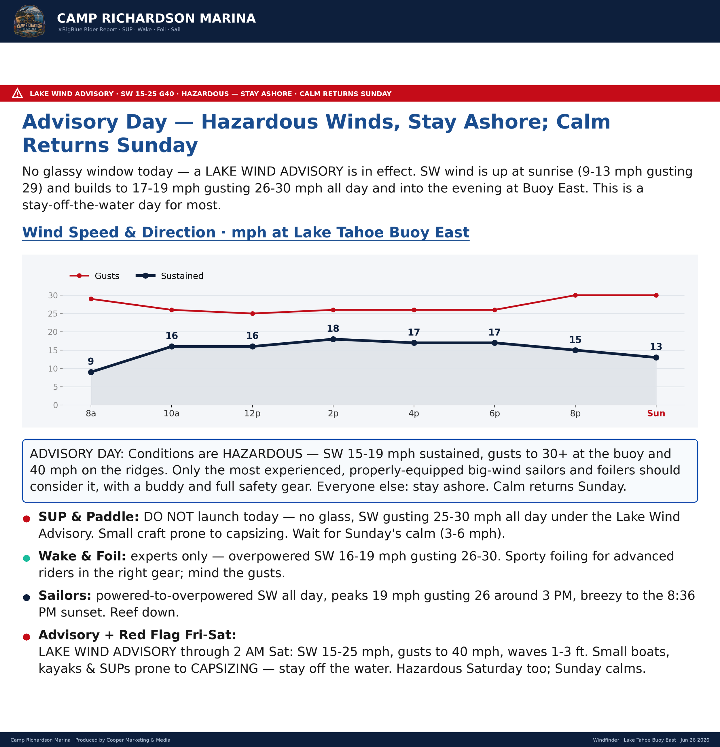
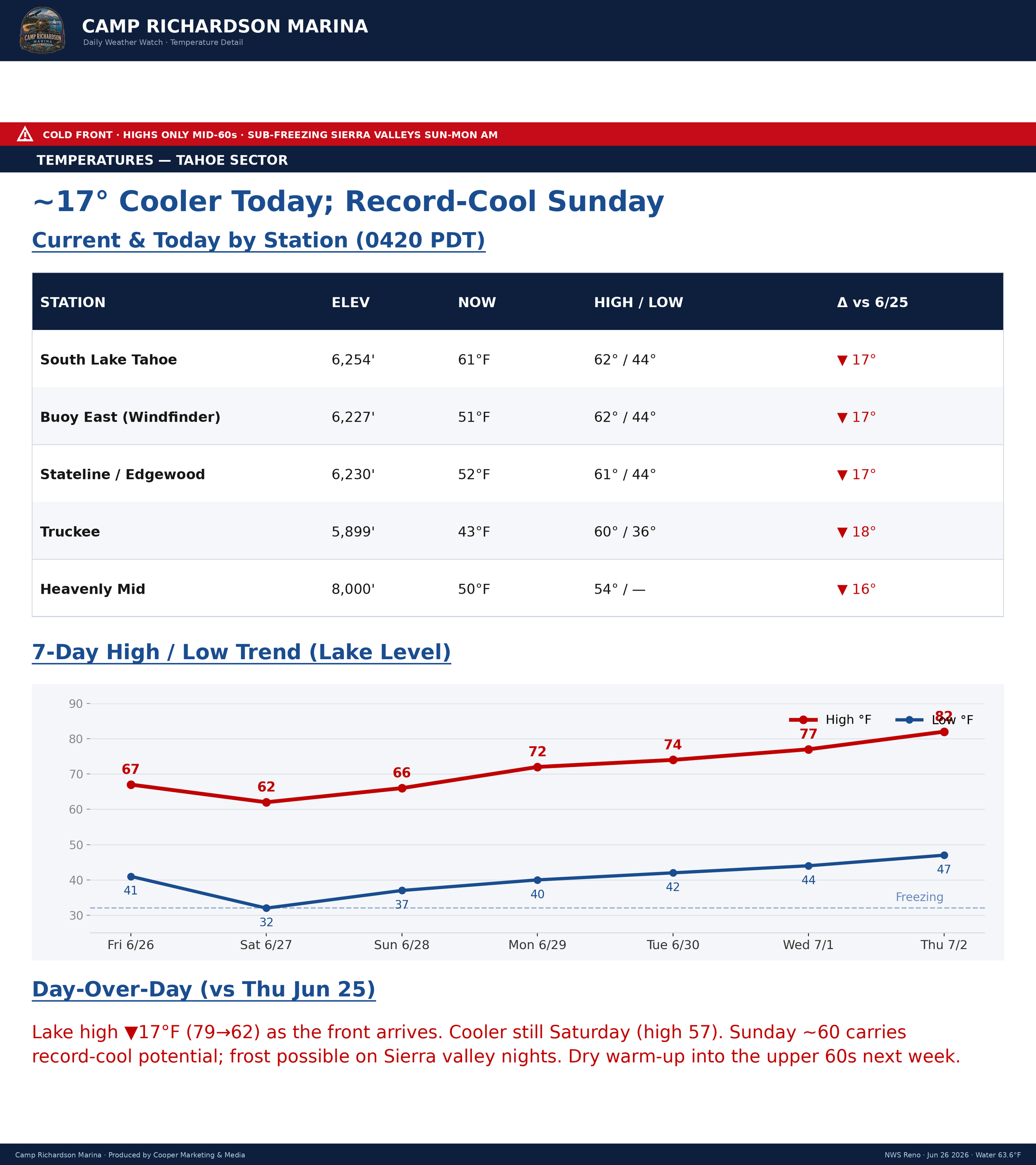
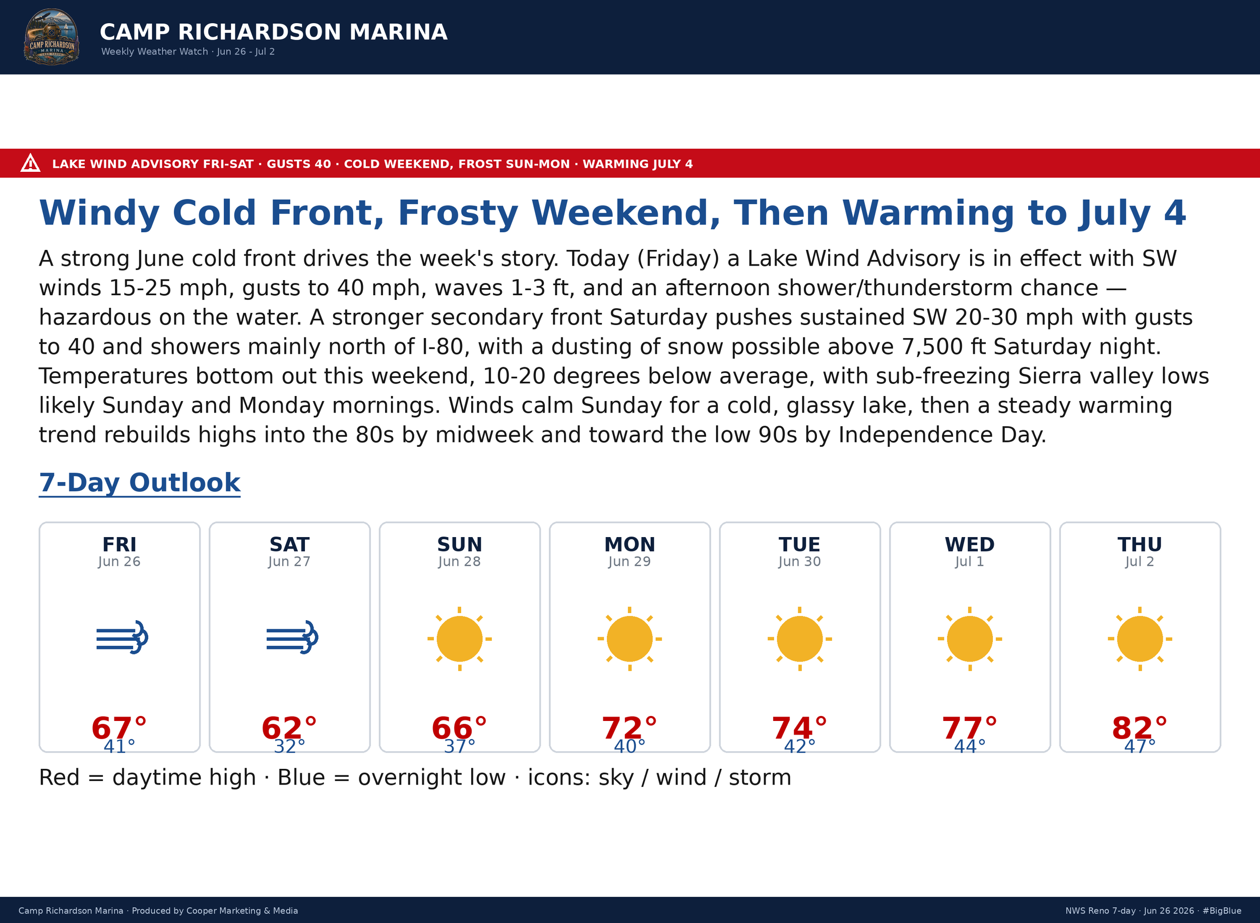
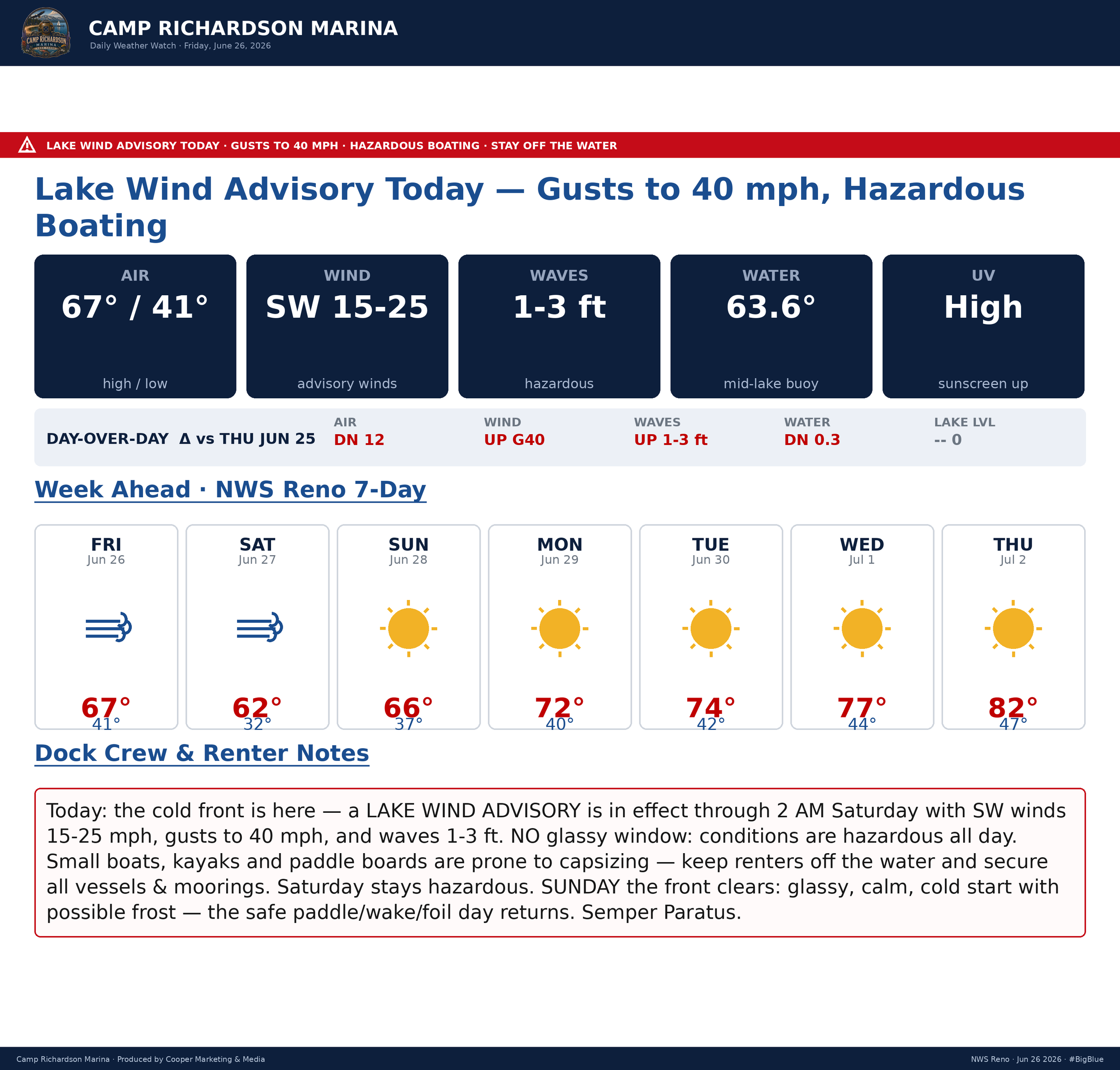
Cup'O'Joe in hand, #StokeLevelSolid, winds blowin', temps dropping, clouds above as I type on this # FreakFlagFly'n Friday. It was going to be Pirate weekend down at the marina; however, with the current guidance and forecast and #MotherNature tossing a June hissy-fit, we are going to postpone until next weekend. But for today and tomorrow, #BigBlue is blown-out. Winds SW (214º) at 14mph forecast to increase with gusts in 18/19mph zone with a few calls for 30+. Temps are dropping today through Saturday, then rebounding back to summertime Tahoe-style. Funny how #MotherNature can toy with us, hot, cool, warm, wind, snow, snain, and rain… A few models have the possibility of snain/snow north of I80 at 7,500’…
Today, hit the West Shore and the bike trail from Obexer's to Squaw and pop into all of the lil-shops along the way. There are a few awesome frostie adult libation stations between Obex and Squaw, and a fun day of trail riding for sure. Another option is the Via Ferrata. The Tahoe Via Ferrata is a guided, assisted rock climbing experience on the Tram Face in Olympic Valley. A fun time for all, and quite the experience. Or just take a stroll in downtown Truckee and enjoy the local shops and TRK vibe. All's good; all's another day in the life here in Tahoe. Get'out and get'cha some, my friends
"Gratitude is the recognition of all that holds us in the web of life and all that has made it possible to have the life that we have and the moment that we are experiencing."
― Dalai Lama XIV, The Book of Joy: Lasting Happiness in a Changing World
Stay'nThirsty
Coop|RS#69
NAM 3km - Guidance Models

NAM 3km • Precip 6hr • T850

NAM 3km • 6hr MAX Temps (ºf)

NAM 3km • 80m Wind Speeds + Streamlines (Knots)

NAM 3km • 0-6km Wind Shear (Knots)